Short answer: yes.
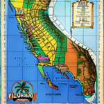
About two-thirds of Florida is a peninsula, a long finger of land between the Gulf of Mexico and the Atlantic Ocean, with the Straits of Florida off its southern end.
Everything else is the Panhandle, which runs west along the northern Gulf until it hits Alabama.
That part isn’t the peninsula.
I rewrote this page in October 2026 and folded our old “Is Florida the largest peninsula?” post into it, because the two were answering the same question.
Both had problems.
One said the Panhandle sticks out “westward into the Gulf of Mexico.”
It doesn’t.
The other claimed Florida formed in northwest Africa about half a billion years ago, which mangles a real story that’s a lot better.

Where the peninsula starts
There’s no sign on the highway.
People use a river instead: the land east and south of the Suwannee counts as peninsular Florida, and west of it you’re in the Panhandle.
That split gives you a nice bit of trivia.
Florida’s highest point, Britton Hill, is 345 feet up in Walton County, way up in the northwest, and it’s the lowest state high point in the country.
Sugarloaf Mountain in Lake County, at 312 feet, is the peninsula’s own top.
Most of the state sits way below either one (Miami and plenty of other coastal towns are under 12 feet).
How big is it?
Florida has about 1,350 miles of coastline, the longest in the lower 48, and that’s before you count its barrier islands.
It’s also the only state that touches both the Gulf and the Atlantic.
All of it together covers 65,758 square miles.
What I couldn’t find is a solid source that measures the peninsula by itself: its exact width, or its own square miles.
So I’m not going to make one up.
“About two-thirds of the state” is the honest figure.
Is it the largest peninsula?
Not in the world, and it’s not close.
Arabia’s peninsula covers about 1.25 million square miles, roughly 19 times the size of all of Florida, Panhandle included.
In the U.S., it depends on what you measure, and the old version of this page got muddled.
Alaska has a peninsula that runs about 497 miles southwest from its mainland toward the Aleutian Islands, plus other big ones like the Kenai and the Seward.
I’d call Florida’s the best-known peninsula in the country, but calling it the biggest is a claim I’d want real numbers for, and I haven’t found a ranking I trust.

🗼 I Wrote a Book About My Japan Travel Catastrophes!
Before I landed in Tokyo, I thought I was the “Final Boss” of international travel. Spoiler alert: I WASN’T. 😅
🚅 I boarded the wrong Shinkansen and ended up in THE WRONG CITY. I confused locals with my “expert” bowing that was more awkward than accurate. I accidentally stumbled into a high-stakes Kendo practice thinking it was a tourist show. Sound like something you’d do?
“Things I Wish I Knew Before Going to Japan” is your shortcut to avoiding ALL my cringe-worthy mistakes. ✨ Inside, you’ll find practical, LIFE-SAVING tips on etiquette, transport, money, and hidden gems that will save you time, money, and a whole lot of confusion.
Why Florida is a peninsula at all
This is the part worth knowing.
Florida sits on the Florida Platform, a flat shelf of rock under the whole state, and most of its deepest rock started out as part of Africa, on the West African coast near what’s now Senegal.
It got attached to North America as the supercontinent Pangaea came together.
When Pangaea broke up in the Jurassic, that piece stayed with North America instead of going back with Africa.
Geologists have even found that one of its buried granites, the Osceola Granite, resembles a granite in Senegal.
Then the sea took over.
For most of its recent history the platform sat underwater, and its rock layers are mostly marine.
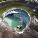
Today the peninsula is a porous plateau of limestone, which is why Florida has so many springs, underwater caves and sinkholes.
Turns out the shape keeps changing, too.
During the last ice age, with sea levels lower, the peninsula was much wider than it is now, and mostly savanna.
What it means for your trip
Being a peninsula means you’re rarely far from salt water.
Back in 2012, 75% of Floridians lived within 10 miles of the coast.
You also get two different coasts in one state.
If you’ve booked a beach week in the off-season and the weather turns on one side, the other coast is a drive away, not a flight.
It’s also why Florida takes so many hurricanes.
Hurricane season runs June 1 to November 30 and peaks from August to October, and Florida, with warm water along that long coastline, is the most hurricane-prone state.
Honestly, that’s the one geography fact that should shape your dates.
Our hurricane season tool shows the odds month by month.
For what’s going on under your feet, read why Florida has so many sinkholes, or browse our Florida geography guide.
And if you’re wondering about the skinny strip of land off Miami, we’ve covered whether Miami Beach is an island or a peninsula.