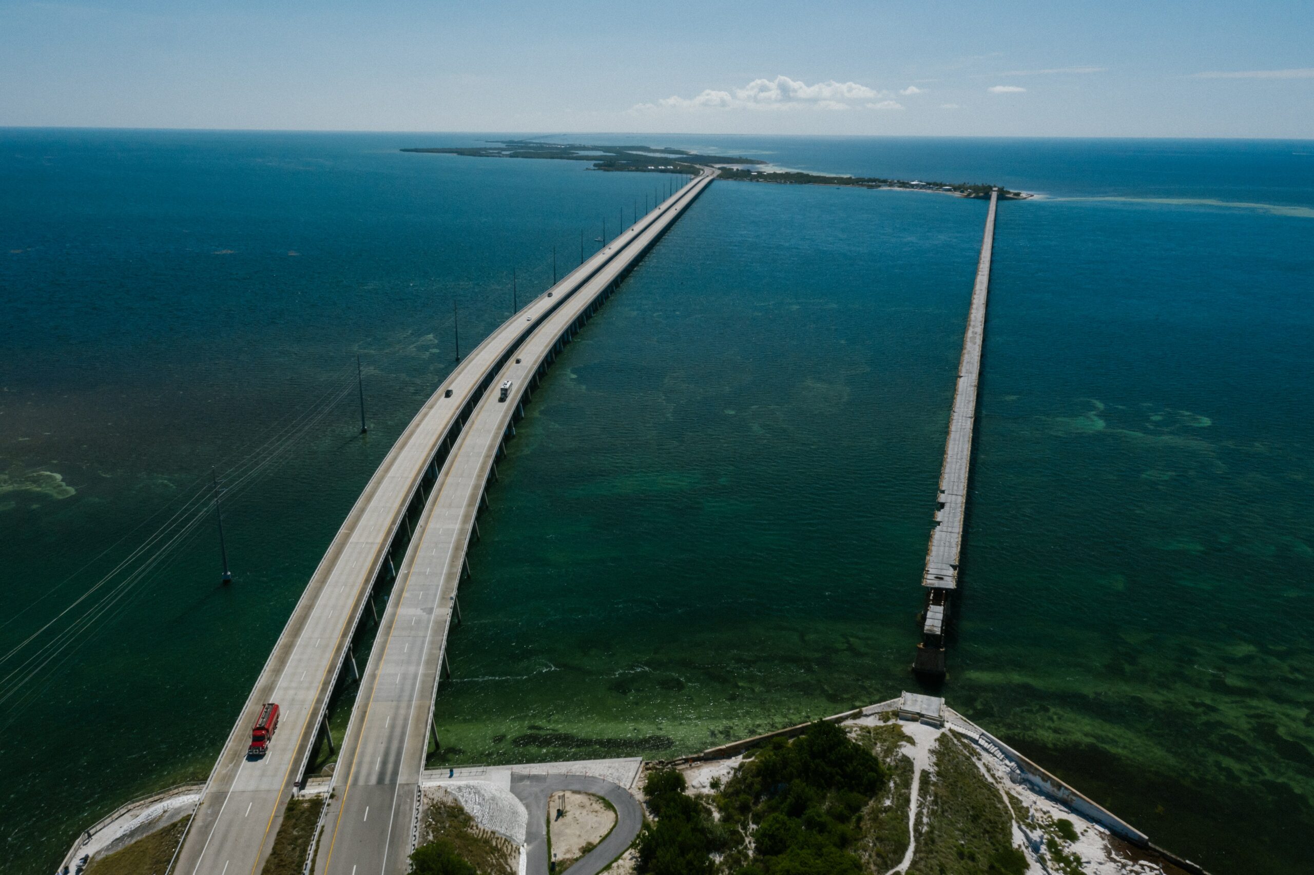

Short answer: the Seven Mile Bridge in the Florida Keys.
By the state’s own measure it’s 35,867 feet, a little under 6.8 miles, running from Knight’s Key in Marathon to Little Duck Key in the Lower Keys.
Nothing else in Florida comes close.
The runner-up, the Sunshine Skyway over Tampa Bay, is about 4.1 miles.
I rewrote this post in October 2026 because its old table was a mess.
It gave the John Ringling Causeway 3.6 miles (the bridge is about 3,100 feet), listed a bridge in Texas, and described an “Eight Mile Bridge” that doesn’t appear on the state’s list of long bridges.
Here’s the list as Florida’s DOT measures it.

Florida’s five longest bridges
| Bridge | Crosses | Length | Opened |
|---|---|---|---|
| Seven Mile Bridge | Moser Channel, Florida Keys | 35,867 ft (6.8 mi) | 1982 |
| Sunshine Skyway | Tampa Bay | 21,875 ft (4.1 mi) | 1987 |
| St. George Island Bridge | Apalachicola Bay | 21,542 ft (4.1 mi) | 2003 |
| Mid-Bay Bridge | Choctawhatchee Bay | 19,267 ft (3.6 mi) | 1993 |
| Garcon Point Bridge | East Bay | 18,427 ft (3.5 mi) | 1999 |
Lengths are the Florida Department of Transportation’s figures for over-water road bridges, as collected in Wikipedia’s list of Florida bridges.
Note how close No. 2 and No. 3 are.
The St. George Island Bridge over Apalachicola Bay is only about 330 feet shorter than the Skyway, and I’d bet most Florida visitors have never heard of it.
Why the causeways don’t win
You’ll see bigger numbers for causeways, and they’re real, just not bridge lengths.
The Courtney Campbell Causeway between Clearwater and Tampa is almost 10 miles long.
Its longest stretch over open water?
Just over half a mile.
A causeway is a road on top of an embankment across the water, so only part of it is actually bridge.
Same goes for the Rickenbacker Causeway, which links Miami to Virginia Key and Key Biscayne and runs 5.4 miles end to end.
So if the question is “longest bridge over water,” it’s the Seven Mile, by a long way.

Your Ultimate Caribbean Adventure Awaits!
Discover hidden coves, secret beaches, and the best rum punches in the islands. Your insider’s guide to Caribbean paradise.
Get Your Guide Now$15.99The Seven Mile Bridge, up close
It’s two bridges, really, and I think the old one is the better story.
The old one went up from 1909 to 1912 as part of Henry Flagler’s Overseas Railroad to Key West.
After the 1935 Labor Day hurricane damaged the railroad, the government turned the bridge into a road, and old rails were painted white and reused as guardrails.
Its replacement, the one you drive today, was built from 1978 to 1982.
It has 440 spans, most of them low over the water, with a hump near the middle that gives boats 65 feet of clearance.
It also carries the Florida Keys aqueduct, which supplies water to points west.
The new bridge is also the line between the Middle Keys and the Lower Keys, so you know you’re getting close to Key West once you’re across.
Walking the old bridge to Pigeon Key
Honestly, this is the part I’d plan a stop around.
A 2.2-mile section of the old bridge leads to Pigeon Key, a five-acre island that was the railroad’s work camp, where up to 400 workers lived from 1908 to 1912.
Cars were banned from that section in 2008 after parts began to sag.
The state approved a $77 million restoration, and it reopened to walkers and cyclists in January 2022.
Today it’s a walking, running, biking and fishing path, and at the end there’s a museum on the island.
We’ve got the details in can you walk the 7 Mile Bridge and can you bike across it.
One heads-up if you’ve booked a Keys trip in April: the new bridge closes for about two and a half hours on a Saturday for the Seven Mile Bridge Run.
Plan your drive around it.
Wondering which Florida bridge has the scariest climb instead?
That’s a different answer, and it’s in what is the steepest bridge in Florida.
The rest of our bridge posts are in the Florida bridges guide.