It’s the Yellowstone.
If you want one name for the longest free-flowing river in the US, that’s it: the National Park Service and the U.S. Geological Survey both call it the longest undammed river in the lower 48 states, at 671 miles from its source southeast of Yellowstone National Park to the Missouri River.
But two words in that answer are doing a lot of work, “undammed” and “lower 48.”
I’ll get to both, because they’re the whole reason people argue about this.
The Mississippi isn’t the longest free-flowing river in the country, and it’s not close: the upper Mississippi alone runs through a system of 29 locks and dams.
And a heads-up: the facts here come from the Park Service’s Yellowstone and Mississippi pages, the USGS, the Bureau of Reclamation, rivers.gov and the text of the Wild and Scenic Rivers Act, a Minnesota DNR notice, an MPR News story and a 2019 study in Nature, as of early November 2026.
If you’ve booked a Yellowstone trip and only want the park, our Yellowstone National Park guide is the better place to start.
Dams Have Modified About 17 Percent of America’s Rivers

I’d start with the numbers, because they explain why free-flowing is rare enough to rank at all.
Rivers.gov, the federal site for the National Wild and Scenic Rivers System, says more than 75,000 large dams across the country have modified at least 600,000 miles of American rivers.
That’s about 17 percent.
And the site adds it could be more than 20, since the figures are best estimates.
Now the other side of the ledger.
Through 2023, the national system protected 13,467 miles of 228 rivers in 41 states and Puerto Rico.
That’s less than half of one percent of the nation’s rivers, which I find kind of wild.
Do the math and you get more than 40 dam-modified miles for every protected one.
Out west the share is even smaller.
Montana has roughly 169,829 miles of river, and 408 of them are designated wild and scenic (about two-tenths of one percent).
Next door, Wyoming also has 408 designated miles, out of about 108,767.
Honestly, that’s a small number for a state the Yellowstone runs through.
So what does free-flowing actually mean?
Turns out the law that set up the system, the Wild and Scenic Rivers Act of 1968, spells it out: “existing or flowing in natural condition without impoundment, diversion, straightening, rip-rapping, or other modification of the waterway.”
Then comes the fine print.
Low dams, diversion works and other minor structures already there when a river is proposed “shall not automatically bar its consideration.”
In other words, even the law doesn’t treat one low dam as the end of the conversation.
Keep that in mind when you get to the Yellowstone below.
Same act, same year, and Congress said the quiet part out loud.
It wrote that the country’s established policy of dam and other construction on its rivers needed a second policy beside it, one that would keep other selected rivers free-flowing.
The upshot: dams were the default and protection was the exception.
That’s Hoover Dam in the photo, seen from above, with its reservoir backed up behind the wall.
If your river questions are more Florida-sized, we’ve also covered how deep the St. Johns River gets and which Florida lakes have clear water.
The Longest Free-Flowing River in the US Comes With Fine Print

Here’s the answer in the agencies’ own words.
The Park Service calls the Yellowstone “the last free-flowing river in the lower 48 states,” and says that from its headwaters to its meeting with the Missouri in North Dakota, “it is undammed and untamed.”
I like how USGS puts it, more plainly.
Spanning 671 miles, it’s the longest undammed river in the Lower 48.
Fine print number one: undammed doesn’t mean you’ll find nothing in the water.
Near Glendive, Montana, the Bureau of Reclamation’s Lower Yellowstone Project (a 58,000-acre irrigation project) has an intake diversion dam on the river.
In 2022, Reclamation, the Army Corps of Engineers and the Fish and Wildlife Service announced a finished 2.1-mile bypass channel around it, built for the endangered pallid sturgeon.
They say the new weir and the channel open about 165 river miles of potential spawning habitat.
So undammed, the way the agencies use it, leaves room for a diversion dam.
I don’t think that’s a gotcha.
It’s pretty much what the word means on a working river that waters farms.
Fine print number two is the lower 48, and Alaska is a different animal.
According to the University of Alaska Fairbanks’ Geophysical Institute, the Yukon is Alaska’s longest river by far.
It’s also the third longest in the US, after the Mississippi and the Missouri, on a 2,000-mile run from northwest Canada to the Bering Sea.
There’s no official ranking of free-flowing rivers that counts Alaska, so no river gets the crown here.
When you see a page say the Yellowstone is the longest free-flowing river “in the US,” check whether it meant the lower 48.
The agencies’ own pages say lower 48.
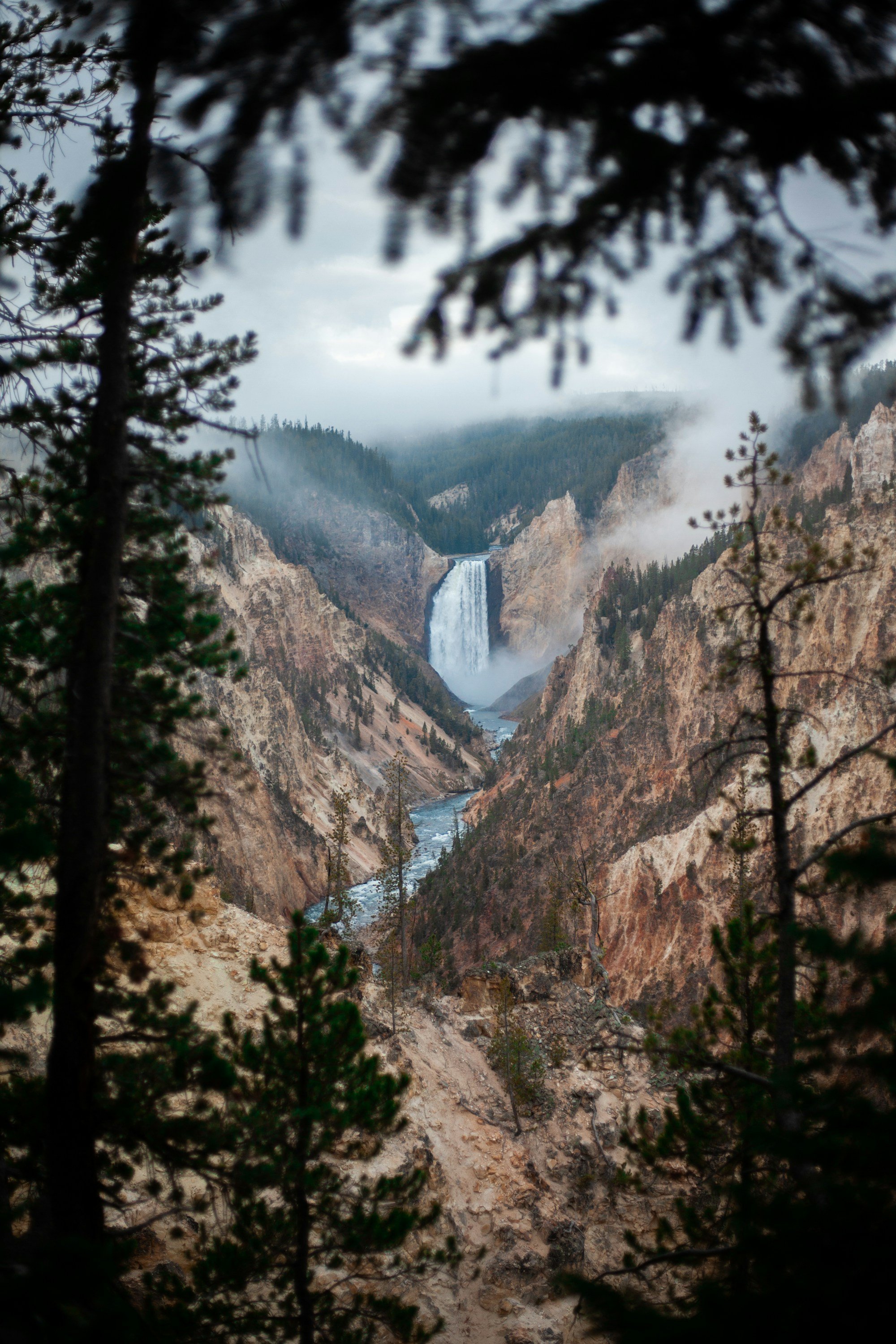
That’s the Yellowstone River in the photo, at the bottom of its Grand Canyon inside the park.
Wyoming has more than the park, by the way.
Here’s what people do in Jackson Hole.
The Upper Mississippi Runs Through 29 Locks and Dams

Short answer for the Mississippi: no.
Barges and their tows move about 175 million tons of freight a year on the upper Mississippi, the Park Service says, through a system of 29 locks and dams.
Put that next to the 1968 definition (“without impoundment, diversion, straightening”) and you can see the problem.
If you’re in Minneapolis, Upper St. Anthony Falls is the northernmost lock and dam, per the Park Service.
Its lock closed to boats for good in June 2015.
MPR News called it the first time a navigable waterway in the United States had been closed to slow the spread of an invasive species.
Minnesota’s Department of Natural Resources backed the Army Corps’ closure as a barrier against invasive carp.
If you paddle that stretch, the DNR’s notice at the time sent paddlers to a 1.5-mile paved portage from Flagpole Plaza, with Bohemian Flats below Lower St. Anthony Falls as the put-in.
It also told every boat to stay at least 600 feet above the dam.
I’d check the current rules before you go, since that notice is from 2015.
The photo is a pusher tug’s tow of barges headed downstream on the Mississippi at Vicksburg, Mississippi.
Then there’s the claim that the Mississippi is the third longest river in the world.
Not quite.
Some people call it the third longest river system, the Park Service says, but only by adding the Missouri and the Ohio to it.
On its own it’s the second longest river in North America, at 2,350 miles from Lake Itasca to the Gulf, and the Missouri is about 100 miles longer.
Put those two together and you get 3,710 miles, fourth in the world after the Nile, the Amazon and the Yangtze.
Don’t get too attached to any one length, though.
USGS has published 2,300 miles and the EPA 2,320, because a delta grows and shrinks and people measure it differently.
What genuinely impresses me is the watershed.
The Mississippi drains all or part of 31 states and two Canadian provinces, about 40 percent of the continental US.
That’s the fourth largest watershed in the world.
At Lake Itasca it’s only 20 to 30 feet wide.
Water leaving the lake takes about three months to reach the Gulf, moving about 1.2 miles an hour at the headwaters (about half your walking speed) and about 3 at New Orleans.
One name, two very different trips.
If it’s the state of Mississippi you’re after, here’s Gulfport or Biloxi, and for a wider look at the map, which US states have peninsulas.

🗼 I Wrote a Book About My Japan Travel Catastrophes!
Before I landed in Tokyo, I thought I was the “Final Boss” of international travel. Spoiler alert: I WASN’T. 😅
🚅 I boarded the wrong Shinkansen and ended up in THE WRONG CITY. I confused locals with my “expert” bowing that was more awkward than accurate. I accidentally stumbled into a high-stakes Kendo practice thinking it was a tourist show. Sound like something you’d do?
“Things I Wish I Knew Before Going to Japan” is your shortcut to avoiding ALL my cringe-worthy mistakes. ✨ Inside, you’ll find practical, LIFE-SAVING tips on etiquette, transport, money, and hidden gems that will save you time, money, and a whole lot of confusion.
The Yellowstone Is Wild, Just Not Legally a Wild River

In everyday English, sure, the Yellowstone is wild.
In the law’s English, it isn’t a wild river at all.
A wild river, in the national system, is one “free of impoundments and generally inaccessible except by trail, with watersheds or shorelines essentially primitive and waters unpolluted.”
Rivers.gov is a bit blunt about the labels.
Wild, scenic and recreational “have little to do with recreation, scenery, or wilderness.”
They measure how developed a river was when it was designated.
And the Yellowstone isn’t on the list.
Of the 233 designated rivers in Rivers.gov’s own “Find a river” picker, not one is the Yellowstone.
Its state pages list three in Montana (East Rosebud Creek, the Flathead and the Missouri), two in Wyoming (the Clarks Fork and the Snake River Headwaters) and none in North Dakota, where the Yellowstone meets the Missouri.
So calling the Yellowstone “a wild river” only works if you mean it loosely.
That’s where the law draws the line.
What you get instead is a river you can follow from the top.
It begins on Yount Peak in the Absaroka Range and runs through the Thorofare region into Yellowstone Lake.
From the lake it leaves at Fishing Bridge, then flows north over LeHardys Rapids and through Hayden Valley.
Then it drops into the Grand Canyon of the Yellowstone, which I’d call the main event: roughly 20 miles long, more than 1,000 feet deep and 1,500 to 4,000 feet wide.
Upper Falls is 109 feet.
Lower Falls is 308.
You can’t see both falls from one spot, by the way.
The canyon bends between them.
Plan your timing around the water if the falls are why you’re going.
Flow over the falls runs from about 63,500 gallons a second at peak runoff to 5,000 in the late fall.
So if you go late in the season, you’re seeing less than a tenth of the peak.
That’s the Lower Falls in the photo, at the head of the canyon.
About the name, since you’ll hear a few versions.
The Park Service says the park is named after the river, and the river’s name goes back to French-Canadian trappers who asked the Minnetaree, in what is now eastern Montana.
Their answer was “Mi tse a-da-zi,” literally “Rock Yellow River,” which the trappers turned into “Roche Jaune” or “Pierre Jaune.”
David Thompson wrote it in English, “Yellow Stone,” in 1797.
The Park Service’s account ties the name to the Minnetaree in eastern Montana and doesn’t mention the canyon’s colorful rock, so I wouldn’t lean on the colorful-rock story.
For the park side of all this, our Yellowstone National Park guide is the place to start.
The Amazon, for Scale

And since the Amazon always comes up, here it is with real numbers.
The Park Service puts the Amazon’s discharge at about 209,000 cubic meters a second, against 16,792 for the Mississippi (which ranks 15th in the world).
That’s roughly 12 times the water.
Its basin is about 2.7 million square miles, if you’re keeping score.
The Mississippi’s is about 1.2 million.
But the number that matters for your question comes from a 2019 study in Nature that mapped the world’s free-flowing rivers.
Only 37 percent of rivers longer than 1,000 kilometers (about 620 miles) remain free-flowing over their entire length, and only 23 percent flow uninterrupted to the ocean.
Very long free-flowing rivers, the authors found, are mostly in remote parts of the Arctic and the Amazon and Congo basins.
That’s what makes the Yellowstone stand out to me.
It’s 671 undammed miles in the lower 48, with farms and towns drawing water from it along the way, not a river at the far edge of the map.
The photo is near Manaus, Brazil, where the dark Rio Negro meets the sandy-colored Amazon.
The two run side by side for about 6 kilometers (3.7 miles) without mixing.
If it’s the Amazon itself you want to see, start with our Brazil travel guide.