
Travel Map With Pins
Pin the cities and towns you have been to: type a name, or tap the map and the pin goes on the biggest town near your tap. Your map, your count of countries, continents and U.S. states, to share, print or put on your blog.
My travel map
Your map has no pins yetType a city, or tap the map where you have been: the pin goes on the biggest city near your tap.
Color these countries on the Countries Visited Map
Places: GeoNames (CC BY 4.0). Maps: Natural Earth (public domain). Nothing you pin leaves your browser.
As an Amazon Associate I earn from qualifying purchases. This post contains affiliate links. If you buy through them we may earn a commission at no extra cost to you.
Product prices and availability are accurate as of the date and time indicated and are subject to change. Any price and availability information displayed on Amazon at the time of purchase will apply to the purchase of this product. Certain content that appears on this site comes from Amazon. This content is provided "as is" and is subject to change or removal at any time.
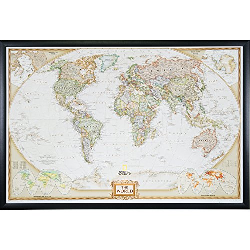
Put a world map with pins on your wall
As an Amazon Associate, TravelMagma earns from qualifying purchases.

$89.99 In Stock
Paid link · price checked October 8, 2026 09:15
$87.77 In Stock
Paid link · price checked October 8, 2026 09:15

$94.99 In Stock
Paid link · price checked October 8, 2026 09:15
Put a U.S. map with pins on your wall
As an Amazon Associate, TravelMagma earns from qualifying purchases.

$89.99 In Stock
Paid link · price checked October 8, 2026 09:15

$75.99 In Stock
Paid link · price checked October 8, 2026 09:15

$58.99 In Stock
Paid link · price checked October 8, 2026 09:15
Make a travel map with pins: type a city, or tap the map where you have been, and a pin goes on the biggest town near your tap. The map counts your countries, continents and U.S. states as you go, and it lives in its own link, so you can share it, print it or put it on your blog. It is free and nothing leaves your browser.
How to use it
Pick the World or the U.S. map. Type a city or town in the box and tap it in the list, or tap the map itself: within about 2° of your tap on the world map (14 pixels on the U.S. map) the pin goes on the town with the most people, so a tap near Paris pins Paris, not a suburb. Tap a pin again, or its ✕ in the list, to take it off. The list keeps your places in the order you added them, which makes it a record of the trip. “Copy link to my map” keeps every pin; “Print my map” prints the map with the list under it; “Put my map on my blog” gives the code for a live copy of this map.
The places you can pin
The towns are the Halfway Point Calculator’s list, from GeoNames: every U.S. place of 5,000 people or more, Canadian places of 10,000 or more, and cities of 150,000 or more everywhere else — 12,076 places in all. Countries are counted the way the Countries Visited Map counts them: the United Nations’ 193 member states and 2 observer states, with places like Puerto Rico and Taiwan counted apart; Hong Kong and Macau count as China, and Réunion as France.
| Continent | Places | Countries | The biggest |
|---|---|---|---|
| Africa | 550 | 49 | Kinshasa |
| Asia | 2,080 | 45 | Shanghai |
| Europe | 570 | 36 | Moscow |
| North America | 8,408 | 14 | Mexico City |
| Oceania | 24 | 3 | Sydney |
| South America | 418 | 12 | São Paulo |
| Other places, not UN states | 26 | 4 | Taipei |
North America’s count is mostly the United States (7,473 places) and Canada (757), because the list goes down to small towns there. A village abroad that is not on the list: pin the nearest city.
Worked examples
- A first trip to Europe: Paris, Rome, Barcelona and Amsterdam make 4 places pinned in 4 countries, on 1 continent. “Color these 4 countries on the Countries Visited Map” opens that map with France, Italy, Spain and the Netherlands filled in.
- A music road trip: Chicago, Nashville, New Orleans and Austin make 4 places pinned in 1 country, 4 U.S. states. On the U.S. map each state with a pin is shaded.
- Two weeks in East Asia: Tokyo, Kyoto, Seoul and Hong Kong make 4 places pinned in 3 countries — Hong Kong counts as China.
- New York, Washington, San Juan and Cancún: 4 places pinned in 2 countries, and 1 other place that is not a UN state (Puerto Rico); 1 U.S. state and DC.
Common mistakes
- Tapping a small town abroad. Outside the U.S. and Canada only cities of 150,000 people are on the list, so a tap pins the biggest city nearby. Type the name instead to see if it is there.
- Looking for Puerto Rico on the U.S. map. The U.S. map shows the 50 states and Washington, DC; Puerto Rico, Guam and the other territories are pinned on the world map.
- Expecting the map to save itself. It lives in its link: copy the link (or bookmark it) after you add places, and the same pins come back.
- Using it as a map of where to go. It works, but the count then says “countries” for places you have not been: keep a second link for the wish list.
Keep the trip
- How to make a travel scrapbook
- Travel journal ideas
- The best gifts for travelers
- Countries & States Visited Map: color in the whole countries and states
- Distance Between Two Cities
FAQ
How do I make a travel map with pins?
Type each city you have been to and tap it, or tap the map near it: each becomes a pin. Then copy the link to keep it, print it, or put it on your blog. There is nothing to sign up for.
How do I make a map of places I’ve been?
Pin the cities here, or color in whole countries and states on the Countries Visited Map; the button under your pins opens it with your countries already filled in.
Can I make a map with pins for free?
Yes: it runs in your browser, holds up to 200 pins in one map, and sends nothing anywhere.
Can I put my travel map on my blog?
Yes: “Put my map on my blog” gives the HTML for your map with its pins, credited to Travel Magma. Paste it where your blog takes HTML; to add places later, add them here and copy the code again.
Can I print my travel map?
Yes: “Print my map” prints the map with your pins and the list of places under it, without the buttons.
Why can’t I find my town?
Outside the U.S. and Canada the list has cities of 150,000 people or more. Pin the nearest city, or tap the map where the town is and the biggest city near it is pinned.
How are the countries counted?
As the United Nations’ 193 member states and 2 observer states; Puerto Rico, Taiwan, Greenland and the other places the map shows are counted apart, and Hong Kong and Macau count as China.