
The first time I went to Olympic National Park, I booked one hotel in Port Angeles for three nights and figured I’d day-trip the whole park from there.
That plan cost me about nine hours behind the wheel of a rental car.
Olympic is nearly a million acres, and the famous parts sit on opposite edges of it.
Here’s the version I’d do now.
Two bases, three days, and a hard look at the calendar first, because this park in November is a different trip than it is in July.
Some roads close, some lodges close, and the rain gets serious.
Two Bases Beat One Hotel

I ignored the Park Service’s advice, so learn from me.
Stay in Port Angeles, or near Lake Crescent, for Hurricane Ridge and Sol Duc.
Stay around Forks for the Hoh Rain Forest and the coast.
Do that.
Look at the park’s own mileage table.
Port Angeles to Hurricane Ridge is 17 miles, about 45 minutes.
Port Angeles to the Hoh Rain Forest Visitor Center is 91 miles, about 2 hours 15 minutes, each way.
Do the Hoh as a day trip from Port Angeles and you’ve spent four and a half hours of your day staring at a windshield.
Most of what you came for hangs off US 101, which loops around the peninsula, like spokes off a wheel.
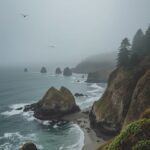
With over 70 miles of wild coastline plus mountains and rain forest, you’re not going to “do” Olympic.
You’re going to pick.
No car?
Clallam Transit runs the bus to Port Angeles, Forks, La Push, Lake Crescent and Neah Bay, per the park.
It works for a slow trip.
It doesn’t work for this one.
Getting There From Seattle


Flying in, you land at SEA.
After a long flight with a layover, I’d skip the peninsula drive that same night.
Jet lag and dark two-lane highways in the rain aren’t a fun combo.
From Seattle you’ve got two ways onto the peninsula: drive around through Tacoma, or take a Washington State Ferry across Puget Sound.
The park names ferry landings at Bainbridge Island and Kingston, plus Port Townsend, that connect to Highway 101.
I take the ferry.
It’s a break from driving, and the view back at the city is free.
One catch the park flags.
State Route 104 crosses the Hood Canal Bridge, which closes now and then for boat traffic.
Hit an opening and you wait, so leave some slack in the day.
Want a day in the city first?
Here’s my kind of Seattle, and a longer list of things to do in Seattle if you’ve got the time.
Your Ultimate Caribbean Adventure Awaits!
Discover hidden coves, secret beaches, and the best rum punches in the islands. Your insider’s guide to Caribbean paradise.
Get Your Guide Now$15.99Hurricane Ridge: Check the Road Before You Go Up


Hurricane Ridge sits at 5,242 feet, at the end of Hurricane Ridge Road.
On a clear day you get a wall of snowy peaks.
On a cloudy day you get a parking lot inside a cloud.
Check the forecast before you burn a morning on it.
In the off-season, the road is the whole question.
As I write this, the park’s conditions page says Hurricane Ridge Road is closed due to snow and will reopen when conditions permit.
Winter operations for 2026-2027 begin November 28, weather permitting.
After that, the road is typically open to uphill traffic from 9 am to 4 pm, Friday through Sunday and some holidays, and it can open as late as noon.
Two rules people miss.
Every vehicle, 4-wheel drive included, has to carry tire chains above the Heart O’ the Hills entrance station from after Thanksgiving through April 1.
And everybody has to be back below that station by 5 pm in winter.
And on Christmas Day, the road is closed.
Pack food, too.
The old Hurricane Ridge Day Lodge was lost to a fire in May 2023, and the park says construction on a new building may start in 2028 at the earliest.
In winter there’s no indoor warming area, no food service and no drinking water up there.
Your car is the warming hut.
Lake Crescent and Marymere Falls

Lake Crescent is 21 miles and about 30 minutes west of the Port Angeles visitor center, and it’s the easiest win in the park.
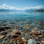
Its water is ridiculously clear, and the lake sits right on 101, so you’ll drive past it anyway.
Stop at the Storm King area and walk the trail to Marymere Falls, a tall, skinny waterfall back in big old trees.
According to the park’s conditions page, the Marymere Falls trailhead is open, and so are the restrooms at Barnes Point.
Traveling with a dog?
On the north shore, the Spruce Railroad Trail is one of the few trails in the park where a leashed pet is allowed.
Most trails are off limits to them, and so is the wilderness.
Lake Crescent Lodge is listed as open as I write this.
But the Fairholme Store and the Log Cabin Resort are listed as closed, so don’t count on them for snacks.
Sol Duc Falls Is Worth the Side Road

From Lake Crescent, the park’s table puts Sol Duc at 16 miles and about an hour.
That ratio tells you what kind of road it is.
It’s narrow and slow, and it’s very green.
At the end, the Park Service says the walk to Sol Duc Falls is just 0.8 of a mile through old-growth forest, and relatively level.
At the falls, the river splits into a few channels and drops into a narrow canyon, and a footbridge crosses right over it.
Stay in the viewing areas.
Even the park’s page asks you to, “so you don’t take an unexpected swim,” and the rocks are slick in every season.
Up this valley, the hot springs resort is a summer operation, so don’t build a November trip around a soak.
Caribbean Paradise Unlocked
From pristine beaches to vibrant local culture, discover the Caribbean’s best-kept secrets with my comprehensive travel guide.
- 120+ Hidden Beach Secrets
- Local Cuisine Guide
- Budget Travel Tips
- Island Hopping Routes
Rialto Beach: Bring a Tide Chart

Rialto Beach is one of the most popular beaches in the park and one of the easiest to reach.
A short path drops you onto a pebble beach with driftwood logs the size of buses and sea stacks offshore.
From Port Angeles, the park’s table says 70 miles and about an hour and a half; from Forks it’s a short drive.
Hikers can walk 1.5 miles north along the beach to the rock arch called Hole-in-the-Wall.
Here’s the part that matters.
Some points on this coast are only passable at lower tides, and the park tells you to carry a tide chart and check NOAA’s tide predictions before you go.
Storms and wind in fall and winter can push the tide higher than the chart says.
So time the walk for a falling tide, keep an eye on your watch and turn around early.
I’ve watched people sprint back across a cove with their shoes in their hands.
It’s funny until it isn’t.
Leashed dogs can go from the parking lot to Ellen Creek, about half a mile up the beach, and no farther.
The Hoh Rain Forest, Early or Late

The Hoh is the picture everyone wants: maple branches wrapped in moss, ferns everywhere, light coming through green.
Do the short Hall of Mosses loop.
It’s under a mile.
Per the park, the Hoh and Quinault rain forests get an average of 12 feet of rain a year.
Twelve feet.
Bring a real rain shell, not a “water-resistant” jacket, and leave the umbrella in the car.
In summer, the line is the problem.
Parking at the Hoh is limited, and the park recommends arriving before 8 am or after 5 pm to avoid waits of up to 2 hours at the entrance station.
Off-season, you mostly skip that, which is the best argument for going in November.
But the Hoh visitor center’s season ran Friday through Sunday through October 31, so don’t plan on a ranger desk.
One more thing.
Heading south from Forks, US 101 crosses the Hoh River Bridge.
Since July 14, 2026, WSDOT has kept that 95-year-old bridge to a single lane, with temporary signals alternating traffic at 25 mph, until a permanent repair is made.
Those full closures this fall are over.
Expect a short wait at the light, and check WSDOT before you drive.
Ruby Beach on the Way South

Ruby Beach is the northernmost beach access in the Kalaloch area, and it’s the one with the sea stacks you’ve seen on every Pacific Northwest calendar.
Per the park’s table, the Kalaloch ranger station is 40 miles and about an hour from the Hoh, and Ruby comes first.
The path down from the lot is short but steep, gravel with drain dips cut across it, built to handle 8.5 feet of rain a year.
Wear shoes with grip.
Winter swells also rearrange the beach logs at the bottom, so the spot where the trail meets the sand changes from storm to storm.
If the tide’s out, walk south past the stacks.
If it’s in and the surf is big, watch it from the top and call it good.
Nobody’s handing out prizes for getting wet.
Kalaloch Lodge and its store are open, per the park, and the beaches between the Hoh and Quinault reservations are the other spot where your leashed dog can come along.
Your Ultimate Caribbean Adventure Awaits!
Discover hidden coves, secret beaches, and the best rum punches in the islands. Your insider’s guide to Caribbean paradise.
Get Your Guide Now$15.99What It Costs to Get In
Olympic’s standard entrance pass is $30 per private vehicle and good for seven days in a row, which covers this whole trip.
An Olympic-only annual pass is $55.
Hitting more parks this year?
An America the Beautiful pass is $80 for US citizens and residents and $250 for non-US residents.
Fees are cashless, so have a card ready, and US residents get in free on the park’s fee-free days, the next being Veterans Day, November 11.
Planning something bigger?
My national park road trips post has six routes that are worth the vacation days.
The 3-Day Loop I’d Do Now
Here’s the whole thing on one screen.
It’s the trip I wish I’d booked the first time, with every drive time from the park’s own table.
Pack light.
A carry-on with a rain shell, a warm layer, shoes that can get soaked and a dry pair for the car is plenty.
Everything else is weather, and Olympic has plenty of that.